Blog Archives
Extent of Storm Damage Visual
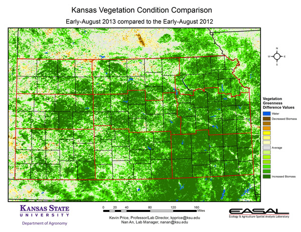
This map came from Kansas State University in a newsletter where they were talking about the vegetation differences from the Drought of 2012 to 2013 in Kansas. A colleague shared this with me pointing out how obvious the storm in Clay County, NE is on this map. Look above Kansas to the brown area-that’s the LOSS of vegetation we have right now in Clay County which is quite extensive-and neat how it’s captured unexpectedly on this map.